- Startpagina /
- Kantoorartikelen /
- Kantoor- & Schoolbenodigdheden /
- Education & Crafts /
- Geography Materials /
- Maps /
- Scotland Postcode Areas Wall Map (A1) - 27.75...
0 ratings


Artikelnr.:
73964190
Scotland Postcode Areas Wall Map (A1) - 27.75" x 34.75" Matte Plastic
Artikelnr.:
73964190
ANG 170
Price Details
Excluding Shipping & Custom charges ( Shipping and custom charges will be calculated on checkout )
*All items will import from VS
0 ratings
Schrijf een beoordeling
Op voorraad
QTY:
Bestel nu en ontvang het rond Monday, Juli 20
Beveiligde transactie
Ubuy works hard to protect your security and privacy. Our advanced payment security system ensures confidentiality by encrypting your information during transmission using AES (Advanced Encryption Standards) and SSL (Secure Socket Layer) protocols. Your payment details are 100% secure as we do not share your payment details with third party sellers.
Onze beste bezorgdiensten
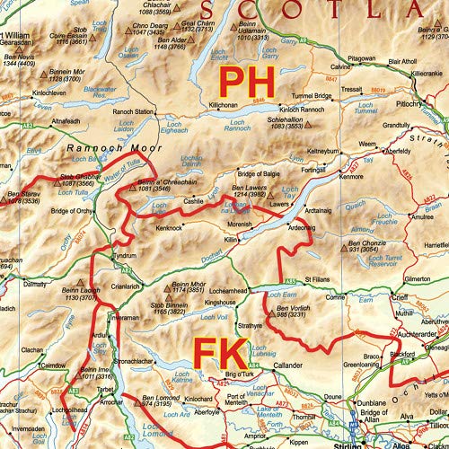
An informative physical wall map of Scotland ideal for the office or educational environment.
Spoedbestelling
Gratis
retourneren*
Stevig verpakt
100% Origineel product
PCI DSS Compliance

ISO 27001 Certified
Wat opvalt
Detailed Postcode Areas
This wall map provides comprehensive coverage of Scotland's postcode areas, making it an essential reference for businesses, collectors, and educators seeking to understand regional divisions.
Durable Matte Plastic
Crafted from high-quality matte plastic, this map is resistant to tearing and fading, ensuring long-lasting durability and a professional appearance suitable for any environment.
Large Format Display
Measuring 27.75" x 34.75", this A1 size map offers clear visibility from a distance, perfect for offices or classrooms where detailed geographical information is needed.
Productdetails
- 27.75 x 34.75 inches. Printed on polypropylene. The material is stronger than most papers and unlikely to crease or rip. The matte finish eliminates glare, and adds texture to the map. Ideal for display. Please note this map is NOT laminated - the page is not appropriate for dry-erase markers. Flat map, tubed for shipping.An informative physical wall map of Scotland ideal for the office or educational environment. This unique map accurately depicts relief. Includes all major towns, roads, rivers, lakes and clearly shows the postcode area boundaries along with the associated postcode Labels.Map created by XYZ Maps, one of Scotland's leading map publishers.Scale 1:650,000
| Artikelgewicht | 1.5 lbs (680 gram) |
Voor wie is dit geschikt?

-
Businesses & Offices
Ideal for businesses located in Scotland needing to reference postcode areas for deliveries and marketing strategies.
-
Educators & Students
Useful for geography teachers and students studying postal regions, improving spatial awareness of Scotland's postcode distribution.
-
Reisplanners
Great for individuals planning trips to Scotland who need to understand regional postal divisions for effective itinerary creation.

-
Casual gebruikers
Not suitable for individuals who only need brief information about Scotland without requiring detailed postal area layout.
-
Online Businesses
A digital solution would be more effective for online businesses that operate outside physical locations in Scotland.
-
Kleine Ruimtes
Users with limited wall space may find the A1 size too large or cumbersome to fit in their environment.
PRODUCTBESCHRIJVING
Heeft u een vraag? Chat met ons
Vragen & Antwoorden van klanten
-
vraag:
Is the map laminated?
antwoord: No, this map is not laminated. -
vraag:
Can I use dry-erase markers on this map?
antwoord: No, the page is not suitable for dry-erase markers. -
vraag:
How is the map shipped?
antwoord: The map is flat and tubed for shipping.
XYZ Maps Maps Editorial Review
Geen beoordelingen van de redactie gevonden
Klantbeoordelingen en -waardering
3 klantenbeoordelingen
-
5 ster
52%
-
4 ster
48%
-
3 ster
0%
-
2 ster
0%
-
1 ster
0%
Beoordeel dit product
Deel uw mening met andere klanten
Voordelen
- Clear and detailed design
- Durable matte plastic material
- Large, easy-to-read size
- Perfect for educational use
- Great for planning trips
Nadelen
- Some colors may appear slightly faded.
Prijs-/productgeschiedenis
Belangrijke informatie
- Beperkingen: voor producten die internationaal worden verzonden, gelieve er rekening mee te houden dat eventuele fabrieksgaranties mogelijk niet geldig zijn; ondersteuningsopties van de fabrikant zijn mogelijk niet beschikbaar; producthandleidingen, instructies en veiligheidswaarschuwingen zijn mogelijk niet in de taal van het land van bestemming; de producten (en bijbehorende materialen) zijn mogelijk niet ontworpen in overeenstemming met de normen, specificaties en etiketteringsvereisten van het land van bestemming; en de producten zijn mogelijk niet in overeenstemming met de voltage- en andere elektriciteitsstandaarden van het land van bestemming (waardoor het gebruik van een adapter of omvormer nodig is, indien van toepassing). De ontvanger is ervoor verantwoordelijk zich ervan te verzekeren dat het product rechtmatig kan worden geïmporteerd naar het land van bestemming. Bij het bestellen bij Ubuy of diens partners geldt de ontvanger als de geregistreerde invoerder en dient zich als zodanig te houden aan alle wetten en voorschriften van het land van bestemming.
- Omdat Ubuy een wereldwijde zoekmachine is, zijn niet alle producten die op Ubuy worden vermeld ook te koop. Producten zijn onderworpen aan wetgeving inzake export en handel.
ANG 170
Bestel nu en ontvang het rond Monday, Juli 20
Dit product is wel in mijn land verkrijgbaar. (Klik op de knop hierboven als dit artikel wel in jouw land verkrijgbaar is. Ons team zal het controleren en aanpassen.)
QTY:
Beveiligde transactie
Ubuy works hard to protect your security and privacy. Our advanced payment security system ensures confidentiality by encrypting your information during transmission using AES (Advanced Encryption Standards) and SSL (Secure Socket Layer) protocols. Your payment details are 100% secure as we do not share your payment details with third party sellers.
Onze beste bezorgdiensten
Snelste wereldwijde bezorging
Kenmerken en voordelen
- Size: 27.75 x 34.75 inches.
- Printed on durable polypropylene material.
- Matte finish eliminates glare and adds texture.
- Accurate depiction of major towns, roads, rivers, and lakes.
- Includes postcode area boundaries and labels.
- Created by one of Scotland's leading map publishers.